Search results for tag #education
![[?]](https://files.defcon.social/dcsocial-s3/accounts/avatars/113/208/344/507/078/943/original/014820ad22daee1c.jpg)
https://theskylive.com/3dsolarsystem?obj=c2025r2
Interactive 3D Orbit Visualization
#space #comets #astrophotography #photography #science #astronomy #nature #NASA #ESA #education
2025 September 18
Comet C/2025 R2 (SWAN)
* Image Credit & Copyright: Team Ciel Austral
https://www.cielaustral.com/
Explanation:
A new visitor from the outer Solar System, comet C/2025 R2 (SWAN) also known as SWAN25B was only discovered late last week, on September 11. That's just day before the comet reached perihelion, its closest approach to the Sun. First spotted by Vladimir Bezugly in images from the SWAN instrument on the sun-staring SOHO spacecraft, the comet was surprisingly bright but understandably difficult to see against the Sun's glare. Still close to the Sun on the sky, the greenish coma and tail of C/2025 R2 (SWAN) are captured in this telescopic snapshot from September 17. Spica, alpha star of the constellation Virgo, shines just beyond the upper left edge of the frame while the comet is about 6.5 light-minutes from planet Earth. Near the western horizon after sunset and slightly easier to see in binoculars from the southern hemisphere, this comet SWAN will pass near Zubenelgenubi, alpha star of Libra, on October 2. C/2025 R2 (SWAN) is scheduled to make its closest approach to our fair planet around October 20.
https://app.astrobin.com/i/i5qsgj
https://earthsky.org/space/new-comet-swan25b-2025/
https://cobs.si/obs_list?id=2659
https://en.wikipedia.org/wiki/C/2025_R2_(SWAN)#Observational_history
https://spaceplace.nasa.gov/comets/en/
https://science.nasa.gov/mission/soho/
https://apod.nasa.gov/apod/ap250918.html
#space #comets #astrophotography #photography #science #astronomy #nature #NASA #ESA #education

* Image Credit & Copyright: Team Ciel Austral
Explanation:
A new visitor from the outer Solar System, comet C/2025 R2 (SWAN) also known as SWAN25B was only discovered late last week, on September 11. That's just day before the comet reached perihelion, its closest approach to the Sun. First spotted by Vladimir Bezugly in images from the SWAN instrument on the sun-staring SOHO spacecraft, the comet was surprisingly bright but understandably difficult to see against the Sun's glare. Still close to the Sun on the sky, the greenish coma and tail of C/2025 R2 (SWAN) are captured in this telescopic snapshot from September 17. Spica, alpha star of the constellation Virgo, shines just beyond the upper left edge of the frame while the comet is about 6.5 light-minutes from planet Earth. Near the western horizon after sunset and slightly easier to see in binoculars from the southern hemisphere, this comet SWAN will pass near Zubenelgenubi, alpha star of Libra, on October 2. C/2025 R2 (SWAN) is scheduled to make its closest approach to our fair planet around October 20.
Authors & editors: Robert Nemiroff (MTU) & Jerry Bonnell (UMCP)
NASA Official: Amber Straughn Specific rights apply.
NASA Web Privacy, Accessibility, Notices;
A service of: ASD at NASA / GSFC,
NASA Science Activation
& Michigan Tech. U.")
Alt...
2025 September 18
Comet C/2025 R2 (SWAN)
* Image Credit & Copyright: Team Ciel Austral
Explanation:
A new visitor from the outer Solar System, comet C/2025 R2 (SWAN) also known as SWAN25B was only discovered late last week, on September 11. That's just day before the comet reached perihelion, its closest approach to the Sun. First spotted by Vladimir Bezugly in images from the SWAN instrument on the sun-staring SOHO spacecraft, the comet was surprisingly bright but understandably difficult to see against the Sun's glare. Still close to the Sun on the sky, the greenish coma and tail of C/2025 R2 (SWAN) are captured in this telescopic snapshot from September 17. Spica, alpha star of the constellation Virgo, shines just beyond the upper left edge of the frame while the comet is about 6.5 light-minutes from planet Earth. Near the western horizon after sunset and slightly easier to see in binoculars from the southern hemisphere, this comet SWAN will pass near Zubenelgenubi, alpha star of Libra, on October 2. C/2025 R2 (SWAN) is scheduled to make its closest approach to our fair planet around October 20.
Authors & editors: Robert Nemiroff (MTU) & Jerry Bonnell (UMCP)
NASA Official: Amber Straughn Specific rights apply.
NASA Web Privacy, Accessibility, Notices;
A service of: ASD at NASA / GSFC,
NASA Science Activation
& Michigan Tech. U.
Cosmos in Reflection
* Image Credit & Copyright: Jeff Dai (TWAN)
https://twanight.org/profile/jeff-dai/
Explanation:
During the day, over 12,000 large mirrors reflect sunlight at the 100-megawatt, molten-salt, solar thermal power plant at the western edge of the Gobi desert near Dunhuang, Gansu Province, China. Individual mirror panels turn to track the sun like sunflowers. They conspire to act as a single super mirror reflecting the sunlight toward a fixed position, the power station's central tower. During the night the mirrors stand motionless though. They reflect the light of the countless distant stars, clusters and nebulae of the Milky Way and beyond. This sci-fi night skyscape was created with a camera fixed to a tripod near the edge of the giant mirror matrix on September 15. The camera's combined sequence of digital exposures captures concentric arcs of celestial star trails through the night with star trails in surreal mirrored reflection.
https://apod.nasa.gov/apod/ap230922.html
#space #earth #astrophotography #photography #astroart #art #science #nature #education

Explanation:
During the day, over 12,000 large mirrors reflect sunlight at the 100-megawatt, molten-salt, solar thermal power plant at the western edge of the Gobi desert near Dunhuang, Gansu Province, China. Individual mirror panels turn to track the sun like sunflowers. They conspire to act as a single super mirror reflecting the sunlight toward a fixed position, the power station's central tower. During the night the mirrors stand motionless though. They reflect the light of the countless distant stars, clusters and nebulae of the Milky Way and beyond. This sci-fi night skyscape was created with a camera fixed to a tripod near the edge of the giant mirror matrix on September 15. The camera's combined sequence of digital exposures captures concentric arcs of celestial star trails through the night with star trails in surreal mirrored reflection.
Authors & editors: Robert Nemiroff (MTU) & Jerry Bonnell (UMCP)
NASA Official: Phillip Newman Specific rights apply.
NASA Web Privacy Policy and Important Notices
A service of: ASD at NASA / GSFC
& Michigan Tech. U.")
Alt...
2023 September 22
Cosmos in Reflection
* Image Credit & Copyright: Jeff Dai (TWAN)
Explanation:
During the day, over 12,000 large mirrors reflect sunlight at the 100-megawatt, molten-salt, solar thermal power plant at the western edge of the Gobi desert near Dunhuang, Gansu Province, China. Individual mirror panels turn to track the sun like sunflowers. They conspire to act as a single super mirror reflecting the sunlight toward a fixed position, the power station's central tower. During the night the mirrors stand motionless though. They reflect the light of the countless distant stars, clusters and nebulae of the Milky Way and beyond. This sci-fi night skyscape was created with a camera fixed to a tripod near the edge of the giant mirror matrix on September 15. The camera's combined sequence of digital exposures captures concentric arcs of celestial star trails through the night with star trails in surreal mirrored reflection.
Authors & editors: Robert Nemiroff (MTU) & Jerry Bonnell (UMCP)
NASA Official: Phillip Newman Specific rights apply.
NASA Web Privacy Policy and Important Notices
A service of: ASD at NASA / GSFC
& Michigan Tech. U.
Star Trails and the Equinox Sunrise
* Image Credit & Copyright: Juan Carlos Casado (TWAN, Earth and Stars)
Acknowledgement: Andrea Rodriguez Anton
Explanation:
Stars trail and the Sun rises in this night and day composite panorama made on March 19. The view looks toward the eastern horizon from La Nava de Santiago, Spain. To create it, a continuous series of digital frames was recorded for about two hours and combined to trace the concentric motion of the stars through the night sky. A reflection of the Earth's rotation, star trails curve around the north celestial pole toward upper left and the south celestial pole toward the lower right. Of course on that day the Sun was near the celestial equator, a diagonal straight line in the wide-angle projection. A dense dimming filter was used to capture the Sun's image every two minutes. Superimposed on the star trails it rose due east in the morning sky. In the scene, foreground landscape and a local prehistoric monument were illuminated by full moonlight, though. The monument's corridor faces nearly to the east and the equinox sunrise.
https://apod.nasa.gov/apod/ap190321.html
#space #earth #astrophotography #photography #astroart #art #science #nature #education

Acknowledgement: Andrea Rodriguez Anton
Explanation:
Stars trail and the Sun rises in this night and day composite panorama made on March 19. The view looks toward the eastern horizon from La Nava de Santiago, Spain. To create it, a continuous series of digital frames was recorded for about two hours and combined to trace the concentric motion of the stars through the night sky. A reflection of the Earth's rotation, star trails curve around the north celestial pole toward upper left and the south celestial pole toward the lower right. Of course on that day the Sun was near the celestial equator, a diagonal straight line in the wide-angle projection. A dense dimming filter was used to capture the Sun's image every two minutes. Superimposed on the star trails it rose due east in the morning sky. In the scene, foreground landscape and a local prehistoric monument were illuminated by full moonlight, though. The monument's corridor faces nearly to the east and the equinox sunrise.
Authors & editors: Robert Nemiroff (MTU) & Jerry Bonnell (UMCP)
NASA Official: Phillip Newman Specific rights apply.
NASA Web Privacy Policy and Important Notices
A service of: ASD at NASA / GSFC
& Michigan Tech. U.")
Alt...
2019 March 21
Star Trails and the Equinox Sunrise
* Image Credit & Copyright: Juan Carlos Casado (TWAN, Earth and Stars)
Acknowledgement: Andrea Rodriguez Anton
Explanation:
Stars trail and the Sun rises in this night and day composite panorama made on March 19. The view looks toward the eastern horizon from La Nava de Santiago, Spain. To create it, a continuous series of digital frames was recorded for about two hours and combined to trace the concentric motion of the stars through the night sky. A reflection of the Earth's rotation, star trails curve around the north celestial pole toward upper left and the south celestial pole toward the lower right. Of course on that day the Sun was near the celestial equator, a diagonal straight line in the wide-angle projection. A dense dimming filter was used to capture the Sun's image every two minutes. Superimposed on the star trails it rose due east in the morning sky. In the scene, foreground landscape and a local prehistoric monument were illuminated by full moonlight, though. The monument's corridor faces nearly to the east and the equinox sunrise.
Authors & editors: Robert Nemiroff (MTU) & Jerry Bonnell (UMCP)
NASA Official: Phillip Newman Specific rights apply.
NASA Web Privacy Policy and Important Notices
A service of: ASD at NASA / GSFC
& Michigan Tech. U.
A Luminous Night
* Image Credit & Copyright: Phil Hart
Explanation:
What shines in the world at night? Just visible to the eye, a rare electric blue glow spread along the shores of Victoria Lake on January 16, 2013. Against reflections of a light near the horizon, this digitally stacked long exposure recorded the bioluminescence of Noctiluca scintillans, plankton stimulated by the lapping waves. Above, the night skies of the Gippsland Lakes region, Victoria, Australia shine with a fainter greenish airglow. Oxygen atoms in the upper atmosphere, initially excited by ultraviolet sunlight, produce the more widely seen fading atmospheric chemiluminescence. Washed out by the Earth's rotation, the faint band of the southern summer Milky Way stretches from the horizon as star trails circle the South Celestial Pole.
https://apod.nasa.gov/apod/ap140809.html
#space #earth #astrophotography #photography #astroart #art #science #education
 & Jerry Bonnell (UMCP)
NASA Official: Phillip Newman Specific rights apply.
NASA Web Privacy Policy and Important Notices
A service of: ASD at NASA / GSFC
& Michigan Tech. U.")
Alt...
2014 August 9
A Luminous Night
* Image Credit & Copyright: Phil Hart
Explanation:
What shines in the world at night? Just visible to the eye, a rare electric blue glow spread along the shores of Victoria Lake on January 16, 2013. Against reflections of a light near the horizon, this digitally stacked long exposure recorded the bioluminescence of Noctiluca scintillans, plankton stimulated by the lapping waves. Above, the night skies of the Gippsland Lakes region, Victoria, Australia shine with a fainter greenish airglow. Oxygen atoms in the upper atmosphere, initially excited by ultraviolet sunlight, produce the more widely seen fading atmospheric chemiluminescence. Washed out by the Earth's rotation, the faint band of the southern summer Milky Way stretches from the horizon as star trails circle the South Celestial Pole.
Authors & editors: Robert Nemiroff (MTU) & Jerry Bonnell (UMCP)
NASA Official: Phillip Newman Specific rights apply.
NASA Web Privacy Policy and Important Notices
A service of: ASD at NASA / GSFC
& Michigan Tech. U.
..
some annotations for previous image and a nice infobanner by STARFRONT OBSERVATORIES
* Image Credit & Copyright: J. De Winter, C. Humbert, C. Robert & V. Sabet
https://www.instagram.com/dwj85
https://www.instagram.com/astro.berto54
https://www.instagram.com/charlesrbert
https://app.astrobin.com/u/victorf#gallery
* Text: Ogetay Kayali (MTU)
https://wwhttps://www.mtu.edu/physics/w.ogetay.com/
Please read more on:
https://www.astrobin.com/jliezm/?force-classic-view
#space #nebula #cluster #astrophotography #photography #science #astronomy #nature #NASA #ESA #education

Alt...
Some annotations for the previous post from their astrobin account.
 released their own breathtaking take on this region. Not only was their processing exquisite, but their scientific analysis of the field was remarkable. We warmly encourage you to explore their description — without a doubt the finest explanation of this part of the sky that we know of")
Alt...
a nice infobanner by STARFRONT OBSERVATORIES
The final result brings together three cosmic actors: the Lagoon and Trifid — stellar nurseries where countless new suns are born — and, right beside them, the delicate filaments left behind by a star at the very end of its life.
This contrast between creation and destruction, between stellar birth and stellar death, is what inspired the title of this mosaic.
Just a few weeks ago, Team FACT (@French Amateur Collaborative Telescope) released their own breathtaking take on this region. Not only was their processing exquisite, but their scientific analysis of the field was remarkable. We warmly encourage you to explore their description — without a doubt the finest explanation of this part of the sky that we know of
2025 September 17
Nebulas and Clusters in Sagittarius
* Image Credit & Copyright: J. De Winter, C. Humbert, C. Robert & V. Sabet
https://www.instagram.com/dwj85
https://www.instagram.com/astro.berto54
https://www.instagram.com/charlesrbert
https://app.astrobin.com/u/victorf#gallery
* Text: Ogetay Kayali (MTU)
https://www.ogetay.com/
https://www.mtu.edu/physics/
Explanation:
Can you spot famous celestial objects in this image? 18th-century astronomer Charles Messier cataloged only two of them: the bright Lagoon Nebula (M8) at the bottom, and the colorful Trifid Nebula (M20) at the upper right. The one on the left that resembles a cat's paw is NGC 6559, and it is much fainter than the other two. Even harder to spot are the thin blue filaments on the left, from supernova remnant (SNR G007.5-01.7). Their glow comes from small amounts of glowing oxygen atoms that are so faint that it took over 17 hours of exposure with just one blue color to bring up. Framing this scene of stellar birth and death are two star clusters: the open cluster M21 just above Trifid, and the globular cluster NGC 6544 at lower left.
https://app.astrobin.com/i/jliezm
https://science.nasa.gov/people/explore-the-night-sky-hubbleatms-messier-catalog-bio/
https://science.gsfc.nasa.gov/662/research/snrs.html
https://en.wikipedia.org/wiki/Doubly_ionized_oxygen
https://en.wikipedia.org/wiki/Open_cluster
https://en.wikipedia.org/wiki/Globular_cluster
https://en.wikipedia.org/wiki/Messier_21
https://apod.nasa.gov/apod/ap250917.html
#space #nebula #cluster #astrophotography #photography #science #astronomy #nature #NASA #education

Explanation:
Can you spot famous celestial objects in this image? 18th-century astronomer Charles Messier cataloged only two of them: the bright Lagoon Nebula (M8) at the bottom, and the colorful Trifid Nebula (M20) at the upper right. The one on the left that resembles a cat's paw is NGC 6559, and it is much fainter than the other two. Even harder to spot are the thin blue filaments on the left, from supernova remnant (SNR G007.5-01.7). Their glow comes from small amounts of glowing oxygen atoms that are so faint that it took over 17 hours of exposure with just one blue color to bring up. Framing this scene of stellar birth and death are two star clusters: the open cluster M21 just above Trifid, and the globular cluster NGC 6544 at lower left.
Authors & editors: Robert Nemiroff (MTU) & Jerry Bonnell (UMCP)
NASA Official: Amber Straughn Specific rights apply.
NASA Web Privacy, Accessibility, Notices;
A service of: ASD at NASA / GSFC,
NASA Science Activation
& Michigan Tech. U.")
Alt...
2025 September 17
A starfield surrounds a several large nebulas that appear mostly red but also white and blue. Dark dust and blue filaments also populate the frame.
Nebulas and Clusters in Sagittarius
* Image Credit & Copyright: J. De Winter, C. Humbert, C. Robert & V. Sabet
* Text: Ogetay Kayali (MTU)
Explanation:
Can you spot famous celestial objects in this image? 18th-century astronomer Charles Messier cataloged only two of them: the bright Lagoon Nebula (M8) at the bottom, and the colorful Trifid Nebula (M20) at the upper right. The one on the left that resembles a cat's paw is NGC 6559, and it is much fainter than the other two. Even harder to spot are the thin blue filaments on the left, from supernova remnant (SNR G007.5-01.7). Their glow comes from small amounts of glowing oxygen atoms that are so faint that it took over 17 hours of exposure with just one blue color to bring up. Framing this scene of stellar birth and death are two star clusters: the open cluster M21 just above Trifid, and the globular cluster NGC 6544 at lower left.
Authors & editors: Robert Nemiroff (MTU) & Jerry Bonnell (UMCP)
NASA Official: Amber Straughn Specific rights apply.
NASA Web Privacy, Accessibility, Notices;
A service of: ASD at NASA / GSFC,
NASA Science Activation
& Michigan Tech. U.
TOPIC> Our Solar System
2025 September 14
Planets of the Solar System: Tilts and Spins
* Video Credit: NASA
https://www.nasa.gov/
* Animation: James O'Donoghue (U. Reading)
https://bsky.app/profile/interplanetary.bsky.social
https://www.reading.ac.uk/meteorology/
Explanation:
How does your favorite planet spin? Does it spin rapidly around a nearly vertical axis, or horizontally, or backwards? The featured video animates NASA images of all eight planets in our Solar System to show them spinning side-by-side for an easy comparison. In the time-lapse video, a day on Earth -- one Earth rotation -- takes just a few seconds. Jupiter rotates the fastest, while Venus spins not only the slowest (can you see it?), but backwards. The inner rocky planets across the top underwent dramatic spin-altering collisions during the early days of the Solar System. Why planets spin and tilt as they do remains a topic of research with much insight gained from modern computer modeling and the recent discovery and analysis of hundreds of exoplanets: planets orbiting other stars.
https://apod.nasa.gov/apod/ap250914.html
#space #planets #solarsystem #astrophotography #photography #nature #science #astronomy #physics #NASA #ESA #education
TOPIC> Comets
2025 September 16
New Comet SWAN25B over Mexico
* Image Credit & Copyright: Daniel Korona
Explanation:
A newly discovered comet is already visible with binoculars. The comet, C/2025 R2 (SWAN) and nicknamed SWAN25B, is brightening significantly as it emerges from the Sun's direction and might soon become visible on your smartphone -- if not your eyes. Although the brightnesses of comets are notoriously hard to predict, many comets appear brighter as they approach the Earth, with SWAN25B reaching only a quarter of the Earth-Sun distance near October 19. Nighttime skygazers will also be watching for a SWAN25B-spawned meteor shower around October 5 when our Earth passes through the plane of the comet's orbit. The unexpectedly bright comet was discovered by an amateur astronomer in images of the SWAN instrument on NASA's SOHO satellite. The comet is currently best observed in southern skies but is slowly moving north. The featured image was captured at sunset three days ago just above the western horizon in Zacatecas, Mexico.
https://earthsky.org/space/new-comet-swan25b-2025/
https://earthsky.org/space/new-comet-swan25b-2025/
https://soho.nascom.nasa.gov/data/summary/swan/
https://soho.nascom.nasa.gov/about/about.html
https://apod.nasa.gov/apod/ap250916.html
#space #comets #astrophotography #photography #science #astronomy #nature #NASA #ESA #education
 and nicknamed SWAN25B, is brightening significantly as it emerges from the Sun's direction and might soon become visible on your smartphone -- if not your eyes. Although the brightnesses of comets are notoriously hard to predict, many comets appear brighter as they approach the Earth, with SWAN25B reaching only a quarter of the Earth-Sun distance near October 19. Nighttime skygazers will also be watching for a SWAN25B-spawned meteor shower around October 5 when our Earth passes through the plane of the comet's orbit. The unexpectedly bright comet was discovered by an amateur astronomer in images of the SWAN instrument on NASA's SOHO satellite. The comet is currently best observed in southern skies but is slowly moving north. The featured image was captured at sunset three days ago just above the western horizon in Zacatecas, Mexico.
Authors & editors: Robert Nemiroff (MTU) & Jerry Bonnell (UMCP)
NASA Official: Amber Straughn Specific rights apply.
NASA Web Privacy, Accessibility, Notices;
A service of: ASD at NASA / GSFC,
NASA Science Activation
& Michigan Tech. U.")
Alt...
2025 September 16
A starfield is seen above a horizon and an orange sunset. In the starfield, near the horizon, is a comet with a green head and long tail.
New Comet SWAN25B over Mexico
* Image Credit & Copyright: Daniel Korona
Explanation:
A newly discovered comet is already visible with binoculars. The comet, C/2025 R2 (SWAN) and nicknamed SWAN25B, is brightening significantly as it emerges from the Sun's direction and might soon become visible on your smartphone -- if not your eyes. Although the brightnesses of comets are notoriously hard to predict, many comets appear brighter as they approach the Earth, with SWAN25B reaching only a quarter of the Earth-Sun distance near October 19. Nighttime skygazers will also be watching for a SWAN25B-spawned meteor shower around October 5 when our Earth passes through the plane of the comet's orbit. The unexpectedly bright comet was discovered by an amateur astronomer in images of the SWAN instrument on NASA's SOHO satellite. The comet is currently best observed in southern skies but is slowly moving north. The featured image was captured at sunset three days ago just above the western horizon in Zacatecas, Mexico.
Authors & editors: Robert Nemiroff (MTU) & Jerry Bonnell (UMCP)
NASA Official: Amber Straughn Specific rights apply.
NASA Web Privacy, Accessibility, Notices;
A service of: ASD at NASA / GSFC,
NASA Science Activation
& Michigan Tech. U.
![[?]](https://cdn.masto.host/zirkus/accounts/avatars/109/363/471/129/904/593/original/366278842762c266.png)
Britain has turned its back on arts education in schools, remaining (as Anthony Seldon/FT points out) 'perversely fixated on cognitive skills & memory' rather than fostering creativity & innovative thinking.... and while making some initially positive promises about once again expanding the provision of arts in schools, this remains consternated by the other curriculum demands put on schools & the shadow of past disinvestment in arts educative capacity in schools.

Alt...
The decline of the arts in school has been documented by the Cultural Learning Alliance. Numbers taking GCSEs in the expressive arts have fallen by 42 per cent since 2010. Over 40 per cent of state schools no longer offer music or drama GCSE, while A-level creative arts entries are down by about a quarter. The most deprived areas of the country have seen the sharpest fall, where the need for cultural enrichment is greatest.
2025 September 12
Lunar Eclipse in Two Hemispheres
* Image Credit & Copyright: North - Zhouyue Zhu, South - Lucy Yunxi Hu
https://www.fantasticjoe.com/#/
https://www.astrolucyhu.com/about-lucy
Explanation:
September's total lunar eclipse is tracked across night skies from both the northern and southern hemispheres of planet Earth in these two dramatic timelapse series. In the northern hemisphere sequence (top panel) the Moon’s trail arcs from the upper left to the lower right. It passes below bright planet Saturn, seen under mostly clear skies from the international campus of Zhejiang University in China at about 30 degrees north latitude. In contrast, the southern hemisphere view from Lake Griffin, Canberra, Australia at 35 degrees south latitude, records the Moon’s trail from the upper right to the lower left. Multiple lightning flashes from thunderstorms near the horizon appear reflected in the lake. Both sequences were photographed with 16mm wide-angle lenses and both cover the entire eclipse, with the darkened red Moon totally immersed in Earth's umbral shadow near center. But the different orientations of the Moon’s path across the sky reveal the perspective shifts caused by the views from northern vs. southern latitudes.
https://www.astrolucyhu.com/about-lucy
#space #moon #astrophotography #photography #science #astronomy #nature #NASA #education
 the Moon’s trail arcs from the upper left to the lower right. It passes below bright planet Saturn, seen under mostly clear skies from the international campus of Zhejiang University in China at about 30 degrees north latitude. In contrast, the southern hemisphere view from Lake Griffin, Canberra, Australia at 35 degrees south latitude, records the Moon’s trail from the upper right to the lower left. Multiple lightning flashes from thunderstorms near the horizon appear reflected in the lake. Both sequences were photographed with 16mm wide-angle lenses and both cover the entire eclipse, with the darkened red Moon totally immersed in Earth's umbral shadow near center. But the different orientations of the Moon’s path across the sky reveal the perspective shifts caused by the views from northern vs. southern latitudes.
Authors & editors: Robert Nemiroff (MTU) & Jerry Bonnell (UMCP)
NASA Official: Amber Straughn Specific rights apply.
NASA Web Privacy, Accessibility, Notices;
A service of: ASD at NASA / GSFC,
NASA Science Activation
& Michigan Tech. U.")
Alt...
2025 September 12
Lunar Eclipse in Two Hemispheres
* Image Credit & Copyright: North - Zhouyue Zhu, South - Lucy Yunxi Hu
Explanation:
September's total lunar eclipse is tracked across night skies from both the northern and southern hemispheres of planet Earth in these two dramatic timelapse series. In the northern hemisphere sequence (top panel) the Moon’s trail arcs from the upper left to the lower right. It passes below bright planet Saturn, seen under mostly clear skies from the international campus of Zhejiang University in China at about 30 degrees north latitude. In contrast, the southern hemisphere view from Lake Griffin, Canberra, Australia at 35 degrees south latitude, records the Moon’s trail from the upper right to the lower left. Multiple lightning flashes from thunderstorms near the horizon appear reflected in the lake. Both sequences were photographed with 16mm wide-angle lenses and both cover the entire eclipse, with the darkened red Moon totally immersed in Earth's umbral shadow near center. But the different orientations of the Moon’s path across the sky reveal the perspective shifts caused by the views from northern vs. southern latitudes.
Authors & editors: Robert Nemiroff (MTU) & Jerry Bonnell (UMCP)
NASA Official: Amber Straughn Specific rights apply.
NASA Web Privacy, Accessibility, Notices;
A service of: ASD at NASA / GSFC,
NASA Science Activation
& Michigan Tech. U.
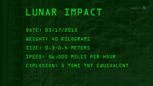
May 17, 2013
Bright Explosion on the Moon - NASA Science
by Alicia Cermak
For the past 8 years, NASA astronomers have been monitoring the Moon for signs of explosions caused by meteoroids hitting the lunar surface. "Lunar meteor showers" have turned out to be more common than anyone expected, with hundreds of detectable impacts occurring every year.
They've just seen the biggest explosion in the history of the program.
"On March 17, 2013, an object about the size of a small boulder hit the lunar surface in Mare Imbrium," says Bill Cooke of NASA's Meteoroid Environment Office. "It exploded in a flash nearly 10 times as bright as anything we've ever seen before."
Anyone looking at the Moon at the moment of impact could have seen the explosion--no telescope required. For about one second, the impact site was glowing like a 4th magnitude star.
Ron Suggs, an analyst at the Marshall Space Flight Center, was the first to notice the impact in a digital video recorded by one of the monitoring program's 14-inch telescopes. "It jumped right out at me, it was so bright," he recalls.
The 40 kg meteoroid measuring 0.3 to 0.4 meters wide hit the Moon traveling 56,000 mph. The resulting explosion1 packed as much punch as 5 tons of TNT.
These false-color frames extracted from the original black and white video show the explosion in progress. At its peak, the flash was as bright as a 4th magnitude star.
Cooke believes the lunar impact might have been part of a much larger event.
"On the night of March 17, NASA and University of Western Ontario all-sky cameras picked up an unusual number of deep-penetrating meteors right here on Earth," he says. "These fireballs were traveling along nearly identical orbits between Earth and the asteroid belt."
[...]
Read more: https://science.nasa.gov/science-research/planetary-science/16may_lunarimpact/
Credits:
Author: Dr. Tony Phillips | Production editor: Dr. Tony Phillips | Credit: Science@NASA
#space #moon #astrophotography #photography #science #astronomy #nature #NASA #education
Alt...
A ScienceCast video describes the bright lunar explosion of March 17, 2013.
2019 January 25
Moon Struck
* Image Credit & Copyright: Petr Horálek
https://www.petrhoralek.com/?page_id=20
Explanation:
Craters produced by ancient impacts on the airless Moon have long been a familiar sight. But only since the 1990s have observers began to regularly record and study optical flashes on the lunar surface, likely explosions resulting from impacting meteoroids. Of course, the flashes are difficult to see against a bright, sunlit lunar surface. But during the January 21 total eclipse many imagers serendipitously captured a meteoroid impact flash against the dim red Moon. Found while examining images taken shortly before the total eclipse phase began, the flash is indicated in the inset above, near the Moon's darkened western limb. Estimates based on the flash duration recorded by the Moon Impact Detection and Analysis System (MIDAS) telescopes in southern Spain indicate the impactor's mass was about 10 kilograms and created a crater between seven and ten meters in diameter.
https://www.petrhoralek.com/?p=4458
https://www.scientificamerican.com/article/in-a-first-earthlings-spot-a-meteor-strike-the-eclipse-darkenhttps://spaceweather.com/archive.php?view=1&day=23&month=01&year=2019ed-moon/
https://spaceweathergallery.com/eclipse_gallery.html
https://apod.nasa.gov/apod/ap011208.html
https://apod.nasa.gov/apod/ap190125.html
#space #moon #astrophotography #photography #science #astronomy #nature #NASA #education
 telescopes in southern Spain indicate the impactor's mass was about 10 kilograms and created a crater between seven and ten meters in diameter.
Authors & editors: Robert Nemiroff (MTU) & Jerry Bonnell (UMCP)
NASA Official: Phillip Newman Specific rights apply.
NASA Web Privacy Policy and Important Notices
A service of: ASD at NASA / GSFC
& Michigan Tech. U.")
Alt...
2019 January 25
Moon Struck
* Image Credit & Copyright: Petr Horálek
Explanation:
Craters produced by ancient impacts on the airless Moon have long been a familiar sight. But only since the 1990s have observers began to regularly record and study optical flashes on the lunar surface, likely explosions resulting from impacting meteoroids. Of course, the flashes are difficult to see against a bright, sunlit lunar surface. But during the January 21 total eclipse many imagers serendipitously captured a meteoroid impact flash against the dim red Moon. Found while examining images taken shortly before the total eclipse phase began, the flash is indicated in the inset above, near the Moon's darkened western limb. Estimates based on the flash duration recorded by the Moon Impact Detection and Analysis System (MIDAS) telescopes in southern Spain indicate the impactor's mass was about 10 kilograms and created a crater between seven and ten meters in diameter.
Authors & editors: Robert Nemiroff (MTU) & Jerry Bonnell (UMCP)
NASA Official: Phillip Newman Specific rights apply.
NASA Web Privacy Policy and Important Notices
A service of: ASD at NASA / GSFC
& Michigan Tech. U.
2007 September 1
Kalamalka Lake Eclipse
* Credit & Copyright: Yuichi Takasaka
http://www.blue-moon.ca/
Explanation:
Recorded on August 28th, this serene total lunar eclipse sequence looks southwest down Kalamalka Lake toward the lights of Coldstream, British Columbia. An exposure every 4 minutes captured the Moon's position and eclipse phase, until the Moon set behind the town lights and a hill on the horizon. In fact, the sequence effectively measures the duration of the total phase of the eclipse. Around 270 BC, the Greek astronomer Aristarchus also measured the duration of lunar eclipses - though probably without the benefit of digital clocks and cameras. Still, using geometry, he devised a simple and impressively accurate way to calculate the Moon's distance, in terms of the radius of planet Earth, from the eclipse duration.
http://www.phy6.org/stargaze/Shipprc2.htm
https://www.mreclipse.com/Special/LEprimer.html
https://apod.nasa.gov/apod/ap070901.html
#space #moon #astrophotography #photography #science #astronomy #nature #NASA #education
 & Jerry Bonnell (UMCP)
NASA Official: Phillip Newman Specific rights apply.
NASA Web Privacy Policy and Important Notices
A service of: ASD at NASA / GSFC
& Michigan Tech. U.")
Alt...
2007 September 1
Kalamalka Lake Eclipse
* Credit & Copyright: Yuichi Takasaka
Explanation:
Recorded on August 28th, this serene total lunar eclipse sequence looks southwest down Kalamalka Lake toward the lights of Coldstream, British Columbia. An exposure every 4 minutes captured the Moon's position and eclipse phase, until the Moon set behind the town lights and a hill on the horizon. In fact, the sequence effectively measures the duration of the total phase of the eclipse. Around 270 BC, the Greek astronomer Aristarchus also measured the duration of lunar eclipses - though probably without the benefit of digital clocks and cameras. Still, using geometry, he devised a simple and impressively accurate way to calculate the Moon's distance, in terms of the radius of planet Earth, from the eclipse duration.
Authors & editors: Robert Nemiroff (MTU) & Jerry Bonnell (UMCP)
NASA Official: Phillip Newman Specific rights apply.
NASA Web Privacy Policy and Important Notices
A service of: ASD at NASA / GSFC
& Michigan Tech. U.
![[?]](https://cdn.masto.host/allmyneighborsearth/accounts/avatars/114/706/953/347/742/654/original/ff9294a0e929b5e3.jpg)
2025 September 11
The Umbra of Earth
* Image Credit & Copyright: Wang Letian (Eyes at Night)
http://www.luckwlt.com/About%20Me.html
http://www.luckwlt.com/
Explanation:
The dark, inner shadow of planet Earth is called the umbra. Shaped like a cone extending into space, it has a circular cross section most easily seen during a lunar eclipse. And on the night of September 7/8 the Full Moon passed near the center of Earth's umbral cone, entertaining eclipse watchers around much of our fair planet, including parts of Antarctica, Australia, Asia, Europe, and Africa. Recorded from Zhangjiakou City, China, this timelapse composite image uses successive pictures from the total lunar eclipse, progressing left to right, to reveal the curved cross-section of the umbral shadow sliding across the Moon. Sunlight scattered by the atmosphere into Earth's umbra causes the lunar surface to appear reddened during totality. But close to the umbra's edge, the limb of the eclipsed Moon shows a distinct blue hue. The blue eclipsed moonlight originates as rays of sunlight pass through layers high in the upper stratosphere, colored by ozone that scatters red light and transmits blue. In the total phase of this leisurely lunar eclipse, the Moon was completely within the Earth's umbra for about 83 minutes.
https://science.nasa.gov/moon/eclipses/
https://en.wikipedia.org/wiki/Lunar_eclipse#Total_lunar_eclipse
https://earthsky.org/astronomy-essentials/total-lunar-eclipse-september-7-2025/
https://earthsky.org/astronomy-essentials/total-lunar-eclipse-september-7-2025/
https://apod.nasa.gov/apod/ap250911.html
#space #moon #astrophotography #photography #science #astronomy #nature #NASA #education

Explanation:
The dark, inner shadow of planet Earth is called the umbra. Shaped like a cone extending into space, it has a circular cross section most easily seen during a lunar eclipse. And on the night of September 7/8 the Full Moon passed near the center of Earth's umbral cone, entertaining eclipse watchers around much of our fair planet, including parts of Antarctica, Australia, Asia, Europe, and Africa. Recorded from Zhangjiakou City, China, this timelapse composite image uses successive pictures from the total lunar eclipse, progressing left to right, to reveal the curved cross-section of the umbral shadow sliding across the Moon. Sunlight scattered by the atmosphere into Earth's umbra causes the lunar surface to appear reddened during totality. But close to the umbra's edge, the limb of the eclipsed Moon shows a distinct blue hue. The blue eclipsed moonlight originates as rays of sunlight pass through layers high in the upper stratosphere, colored by ozone that scatters red light and transmits blue. In the total phase of this leisurely lunar eclipse, the Moon was completely within the Earth's umbra for about 83 minutes.
Authors & editors: Robert Nemiroff (MTU) & Jerry Bonnell (UMCP)
NASA Official: Amber Straughn Specific rights apply.
NASA Web Privacy, Accessibility, Notices;
A service of: ASD at NASA / GSFC,
NASA Science Activation
& Michigan Tech. U.")
Alt...
2025 September 11
The Umbra of Earth
* Image Credit & Copyright: Wang Letian (Eyes at Night)
Explanation:
The dark, inner shadow of planet Earth is called the umbra. Shaped like a cone extending into space, it has a circular cross section most easily seen during a lunar eclipse. And on the night of September 7/8 the Full Moon passed near the center of Earth's umbral cone, entertaining eclipse watchers around much of our fair planet, including parts of Antarctica, Australia, Asia, Europe, and Africa. Recorded from Zhangjiakou City, China, this timelapse composite image uses successive pictures from the total lunar eclipse, progressing left to right, to reveal the curved cross-section of the umbral shadow sliding across the Moon. Sunlight scattered by the atmosphere into Earth's umbra causes the lunar surface to appear reddened during totality. But close to the umbra's edge, the limb of the eclipsed Moon shows a distinct blue hue. The blue eclipsed moonlight originates as rays of sunlight pass through layers high in the upper stratosphere, colored by ozone that scatters red light and transmits blue. In the total phase of this leisurely lunar eclipse, the Moon was completely within the Earth's umbra for about 83 minutes.
Authors & editors: Robert Nemiroff (MTU) & Jerry Bonnell (UMCP)
NASA Official: Amber Straughn Specific rights apply.
NASA Web Privacy, Accessibility, Notices;
A service of: ASD at NASA / GSFC,
NASA Science Activation
& Michigan Tech. U.
TOPIC> The Moon
2025 July 20
Lunar Nearside
* Image Credit: NASA / GSFC / Arizona State Univ. / Lunar Reconnaissance Orbiter
https://www.nasa.gov/
https://www.gsfc.nasa.gov/
https://lroc.sese.asu.edu/index.html
Explanation:
About 1,300 images from the Lunar Reconnaissance Orbiter spacecraft's wide angle camera were used to compose this spectacular view of a familiar face - the lunar nearside. But why is there a lunar nearside? The Moon rotates on its axis and orbits the Earth at the same rate, about once every 28 days. Tidally locked in this configuration, the synchronous rotation always keeps one side, the nearside, facing Earth. As a result, featured in remarkable detail in the full resolution mosaic, the smooth, dark, lunar maria (actually lava-flooded impact basins), and rugged highlands, are well-known to earthbound skygazers. To find your favorite mare or large crater, just follow this link or slide your cursor over the picture. The LRO images used to construct the mosaic were recorded over a two week period in December 2010.
https://lroc.im-ldi.com/visit/exhibits/1/gallery/17
https://apod.nasa.gov/apod/ap250720.html
#space #moon #astrophotography #photography #science #astronomy #nature #NASA #ESA #education

CREDIT
NASA/GSFC/Arizona State University
2025 July 20
Lunar Nearside
* Image Credit: NASA / GSFC / Arizona State Univ. / Lunar Reconnaissance Orbiter
Explanation:
About 1,300 images from the Lunar Reconnaissance Orbiter spacecraft's wide angle camera were used to compose this spectacular view of a familiar face - the lunar nearside. But why is there a lunar nearside? The Moon rotates on its axis and orbits the Earth at the same rate, about once every 28 days. Tidally locked in this configuration, the synchronous rotation always keeps one side, the nearside, facing Earth. As a result, featured in remarkable detail in the full resolution mosaic, the smooth, dark, lunar maria (actually lava-flooded impact basins), and rugged highlands, are well-known to earthbound skygazers. To find your favorite mare or large crater, just follow this link or slide your cursor over the picture. The LRO images used to construct the mosaic were recorded over a two week period in December 2010.
Authors & editors: Robert Nemiroff (MTU) & Jerry Bonnell (UMCP)
NASA Official: Amber Straughn Specific rights apply.
NASA Web Privacy, Accessibility, Notices;
A service of: ASD at NASA / GSFC,
NASA Science Activation
& Michigan Tech. U.")
Alt...
Moon Nearside mosaic
The Moon's diameter is 3474 km (2159 miles)
CREDIT
NASA/GSFC/Arizona State University
2025 July 20
Lunar Nearside
* Image Credit: NASA / GSFC / Arizona State Univ. / Lunar Reconnaissance Orbiter
Explanation:
About 1,300 images from the Lunar Reconnaissance Orbiter spacecraft's wide angle camera were used to compose this spectacular view of a familiar face - the lunar nearside. But why is there a lunar nearside? The Moon rotates on its axis and orbits the Earth at the same rate, about once every 28 days. Tidally locked in this configuration, the synchronous rotation always keeps one side, the nearside, facing Earth. As a result, featured in remarkable detail in the full resolution mosaic, the smooth, dark, lunar maria (actually lava-flooded impact basins), and rugged highlands, are well-known to earthbound skygazers. To find your favorite mare or large crater, just follow this link or slide your cursor over the picture. The LRO images used to construct the mosaic were recorded over a two week period in December 2010.
Authors & editors: Robert Nemiroff (MTU) & Jerry Bonnell (UMCP)
NASA Official: Amber Straughn Specific rights apply.
NASA Web Privacy, Accessibility, Notices;
A service of: ASD at NASA / GSFC,
NASA Science Activation
& Michigan Tech. U.

CREDIT
NASA/GSFC/Arizona State University")
Alt...
Annotations Moon Nearside
Same WAC mosaic with major mare and craters labeled. The Moon's diameter is 3474 km (2159 miles)
CREDIT
NASA/GSFC/Arizona State University
2025 June 28
Lunar Farside
* Image Credit: NASA / GSFC / Arizona State Univ. / Lunar Reconnaissance Orbiter
https://www.nasa.gov/
https://www.gsfc.nasa.gov/
https://lroc.sese.asu.edu/index.html
Explanation:
Tidally locked in synchronous rotation, the Moon always presents its familiar nearside to denizens of planet Earth. From lunar orbit, the Moon's farside can become familiar, though. In fact this sharp picture, a mosaic from the Lunar Reconnaissance Orbiter's wide angle camera, is centered on the lunar farside. Part of a global mosaic of over 15,000 images acquired between November 2009 and February 2011, the highest resolution version shows features at a scale of 100 meters per pixel. Surprisingly, the rough and battered surface of the farside looks very different from the nearside covered with smooth dark lunar maria. A likely explanation is that the farside crust is thicker, making it harder for molten material from the interior to flow to the surface and form dark, smooth maria.
https://apod.nasa.gov/apod/ap250628.html
#space #moon #astrophotography #photography #science #astronomy #nature #NASA #ESA #education
 & Jerry Bonnell (UMCP)
NASA Official: Amber Straughn Specific rights apply.
NASA Web Privacy, Accessibility, Notices;
A service of: ASD at NASA / GSFC,
NASA Science Activation
& Michigan Tech. U.")
Alt...
The lunar farside as never seen before! LROC WAC orthographic projection centered at 180° longitude, 0° latitude
CREDIT
NASA/GSFC/Arizona State University
2025 June 28
Lunar Farside
* Image Credit: NASA / GSFC / Arizona State Univ. / Lunar Reconnaissance Orbiter
Explanation:
Tidally locked in synchronous rotation, the Moon always presents its familiar nearside to denizens of planet Earth. From lunar orbit, the Moon's farside can become familiar, though. In fact this sharp picture, a mosaic from the Lunar Reconnaissance Orbiter's wide angle camera, is centered on the lunar farside. Part of a global mosaic of over 15,000 images acquired between November 2009 and February 2011, the highest resolution version shows features at a scale of 100 meters per pixel. Surprisingly, the rough and battered surface of the farside looks very different from the nearside covered with smooth dark lunar maria. A likely explanation is that the farside crust is thicker, making it harder for molten material from the interior to flow to the surface and form dark, smooth maria.
Authors & editors: Robert Nemiroff (MTU) & Jerry Bonnell (UMCP)
NASA Official: Amber Straughn Specific rights apply.
NASA Web Privacy, Accessibility, Notices;
A service of: ASD at NASA / GSFC,
NASA Science Activation
& Michigan Tech. U.

Alt...
Annotations for the lunar farside.
LROC WAC orthographic projection centered at 180° longitude, 0° latitude
CREDIT
NASA/GSFC/Arizona State University
* The annotations are still unofficial
Tidal locking
results in the Moon rotating about its axis in about the same time it takes to orbit the Earth. Except for libration effects, this results in it keeping the same face turned towards the Earth, as seen in the figure on the upper left. (The Moon is shown in polar view, and is not drawn to scale.)
+ Upper left:
> If the Moon didn't spin at all, then it would alternately show its near and far sides to the Earth while moving around our planet in orbit.
+ Upper right:
> If rotational frequency is larger than orbital frequency, a small torque counteracting the rotation arises, eventually locking the frequencies (situation depicted in green)
+ Down left:
> A simulation shows the variability in the portion of the Moon visible from Earth due to libration over the course of an orbit. Lighting phases from the Sun are not included.
+ Down right:
> Animation of the Moon as it cycles through its phases. The apparent wobbling of the Moon is known as libration
From Wikipedia, the free encyclopedia
CREDITS
Contributors to Wikimedia projects
* Stigmatella aurantiaca
* Jim McKeeth
* Tom Ruen
* Poopooman-ger
#space #moon #astrophotography #photography #science #astronomy #nature #NASA #ESA #education
Alt...
At left, the Moon rotates at the same rate it orbits the Earth, keeping the same face toward the planet. At right, if the Moon did not rotate then the face would change over the course of an orbit. Viewed from above; not to scale.
CREDIT
Stigmatella aurantiaca

CREDIT
Jim McKeeth")
Alt...
If rotational frequency is larger than orbital frequency, a small torque counteracting the rotation arises, eventually locking the frequencies (situation depicted in green)
CREDIT
Jim McKeeth
Alt...
This simulation shows the variability in the portion of the Moon visible from Earth due to libration over the course of an orbit. Lighting phases from the Sun are not included.
One anomalistic lunar cycle (Apogee to Apogee) for April 2007. No phase shown.
CREDIT
Tom Ruen - Own work, created with "Full Sky Observatory" Source bitmap for projection from Nasa's Clementine Spacecraft: USGS: Global simple cylindrical projection at 10 km/pixel. Software: "Full Sky Observatory", by Tom Ruen, described at File:FullSkyAstronomySoftwareLogo.png Source book: "Astronomical Formulae for Calculators, 4th edition", Jean Meeus, 1988, published by "Willmann-Bell, Inc" Chapter 30 "Position of the Moon"
Alt...
Animation of the Moon as it cycles through its phases. The apparent wobbling of the Moon is known as libration.
CREDIT
Poopooman-ger
Orbit the Moon! - LROC WAC Global Mosaic and DTM
The Lunar Reconnaissance Orbiter Camera (LROC) WAC is a push-frame camera that captures seven color bands (321, 360, 415, 566, 604, 643, and 689 nm) with a 57-km swath (105-km swath in monochrome mode) from a 50 km orbit. One of the primary objectives of LROC is to provide a global 100 m/pixel monochrome (643 nm) base map with incidence angles between 55°-70° at the equator, lighting that is favorable for morphological interpretations. Each month, the WAC provides nearly complete coverage of the Moon under unique lighting. As an added bonus, the orbit-to-orbit image overlap provides stereo coverage. Reducing all these stereo images into a global topographic map is a big job, and is being led by LROC Team Members from the German Aerospace Center (Deutsches Zentrum für Luft- und Raumfahrt; DLR). Several preliminary WAC topographic products have appeared in LROC featured images (Orientale basin, Sinus Iridum). For a sneak preview of the WAC global DEM with the WAC global mosaic, view a rotating composite Moon (Full Res).
The global mosaic comprised of over 15,000 WAC images acquired between November 2009 and February 2011. The non-polar images were map projected onto the GLD100 shape model (WAC derived 100 m/pixel DTM), while polar images were map projected on the LOLA shape model. In addition, the LOLA derived crossover corrected ephemeris, and improved camera pointing, provide accurate positioning (100 m) of each WAC image.
CREDIT
LROC
WAC
DLR
https://lroc.im-ldi.com/images/298
#space #moon #astrophotography #photography #science #astronomy #nature #NASA #ESA #education
Alt...
LROC WAC Global Mosaic and DTM
The Lunar Reconnaissance Orbiter Camera (LROC) WAC is a push-frame camera that captures seven color bands (321, 360, 415, 566, 604, 643, and 689 nm) with a 57-km swath (105-km swath in monochrome mode) from a 50 km orbit. One of the primary objectives of LROC is to provide a global 100 m/pixel monochrome (643 nm) base map with incidence angles between 55°-70° at the equator, lighting that is favorable for morphological interpretations. Each month, the WAC provides nearly complete coverage of the Moon under unique lighting. As an added bonus, the orbit-to-orbit image overlap provides stereo coverage. Reducing all these stereo images into a global topographic map is a big job, and is being led by LROC Team Members from the German Aerospace Center (Deutsches Zentrum für Luft- und Raumfahrt; DLR). Several preliminary WAC topographic products have appeared in LROC featured images (Orientale basin, Sinus Iridum). For a sneak preview of the WAC global DEM with the WAC global mosaic, view a rotating composite Moon (Full Res).
The global mosaic comprised of over 15,000 WAC images acquired between November 2009 and February 2011. The non-polar images were map projected onto the GLD100 shape model (WAC derived 100 m/pixel DTM), while polar images were map projected on the LOLA shape model. In addition, the LOLA derived crossover corrected ephemeris, and improved camera pointing, provide accurate positioning (100 m) of each WAC image.
CREDIT
LROC
WAC
DLR
"I'm sorry for you Mastodon users due to insufficiently configured software on your server side you unfortunately only see a third of the displayed images. I can expressly recommend the platform defcon.social to scientifically and creatively interested and committed users of the Fediverse."
Moon Phases
In our entire solar system, the only object that shines with its own light is the Sun. That light always beams onto Earth and Moon from the direction of the Sun, illuminating half of our planet in its orbit and reflecting off the surface of the Moon to create moonlight. Sometimes the entire face of the Moon glows brightly. Other times we see only a thin crescent of light. Sometimes the Moon seems to disappear. These shifts are called moon phases.
The eight lunar phases are, in order: new moon, waxing crescent, first quarter, waxing gibbous, full moon, waning gibbous, third quarter, and waning crescent. The cycle repeats about once a month (every 29.5 days).
Like Earth, the Moon has a day side and a night side, which change as the Moon rotates. The Sun always illuminates half of the Moon while the other half remains dark, but how much we are able to see of that illuminated half changes as the Moon travels through its orbit.
Images:
1.
Position of the Moon and the Sun during each of the Moon’s phases
2. - 9.
All Moon Phases
Let’s take a look at the individual phases, and how the movements of the Moon and Sun appear to us as we watch from the Northern Hemisphere on Earth.
10.
Overview From Space
The Moon orbits Earth from a viewpoint above the North Pole in this animation. The blue gridlines show how the same side of the Moon always faces Earth. The size of the Earth and Moon are enlarged 20 times.
CREDITS:
* NASA's Scientific Visualization Studio
* NASA/JPL-Caltech
https://science.nasa.gov/moon/moon-phases/
#space #moon #astrophotography #photography #science #astronomy #nature #NASA #ESA #education #fediverse #mastodon #defconsocial

Alt...
This graphic shows the position of the Moon and the Sun during each of the Moon’s phases and the Moon as it appears from Earth during each phase.
CREDIT
NASA/JPL-Caltech

Alt...
New Moon
This is the invisible phase of the Moon, with the illuminated side of the Moon facing the Sun and the night side facing Earth. In this phase, the Moon is in the same part of the sky as the Sun and rises and sets with the Sun. Not only is the illuminated side facing away from the Earth, it’s also up during the day! Remember, in this phase, the Moon doesn’t usually pass directly between Earth and the Sun, due to the inclination of the Moon’s orbit. It only passes near the Sun from our perspective on Earth.
CREDIT
NASA/JPL-Caltech

Alt...
Waxing Crescent
This silver sliver of a Moon occurs when the illuminated half of the Moon faces mostly away from Earth, with only a tiny portion visible to us from our planet. It grows daily as the Moon’s orbit carries the Moon’s dayside farther into view. Every day, the Moon rises a little bit later.
CREDIT
NASA/JPL-Caltech

Alt...
First Quarter
The Moon is now a quarter of the way through its monthly journey and you see half of its illuminated side. People may casually call this a half moon, but remember, that’s not really what you’re witnessing in the sky. You’re seeing just a slice of the entire Moon ― half of the illuminated half. A first quarter moon rises around noon and sets around midnight. It’s high in the sky in the evening and makes for excellent viewing.
CREDIT
NASA/JPL-Caltech

Alt...
Waxing Gibbous
Now most of the Moon’s dayside has come into view, and the Moon appears brighter in the sky.
CREDIT
NASA/JPL-Caltech
. The Moon is opposite the Sun, as viewed from Earth, revealing the Moon’s dayside. A full moon rises around sunset and sets around sunrise. The Moon will appear full for a couple of days before it moves into…
CREDIT
NASA/JPL-Caltech")
Alt...
Full Moon
This is as close as we come to seeing the Sun’s illumination of the entire day side of the Moon (so, technically, this would be the real half moon). The Moon is opposite the Sun, as viewed from Earth, revealing the Moon’s dayside. A full moon rises around sunset and sets around sunrise. The Moon will appear full for a couple of days before it moves into…
CREDIT
NASA/JPL-Caltech

Alt...
Waning Gibbous
As the Moon begins its journey back toward the Sun, the opposite side of the Moon now reflects the Moon’s light. The lighted side appears to shrink, but the Moon’s orbit is simply carrying it out of view from our perspective. The Moon rises later and later each night.
CREDIT
NASA/JPL-Caltech

Alt...
Last Quarter
The Moon looks like it’s half illuminated from the perspective of Earth, but really you’re seeing half of the half of the Moon that’s illuminated by the Sun ― or a quarter. A last quarter moon, also known as a third quarter moon, rises around midnight and sets around noon.
CREDIT
NASA/JPL-Caltech

Alt...
Waning Crescent
The Moon is nearly back to the point in its orbit where its dayside directly faces the Sun, and all that we see from our perspective is a thin curve.
CREDIT
NASA/JPL-Caltech
Alt...
The Moon orbits Earth from a viewpoint above the North Pole in this animation. The blue gridlines show how the same side of the Moon always faces Earth. The size of the Earth and Moon are enlarged 20 times.
Overview From Space
Imagine you’re in a spaceship, traveling away from Earth. As you sail onward, you see our planet and its Moon locked together in their endless, circling, gravitational embrace. Your distant view gives you a unique perspective on the Moon that can be hard to visualize from the ground, where the Moon appears to sweep through the sky as an ever-changing globe of light.
From your astronaut’s viewpoint, you can see that the Moon is an average of 238,855 miles (384,399 km) from Earth, or about the space that could be occupied by 30 Earths. It travels around our planet once every 27.322 days in an elliptical orbit, an elongated circle. (It takes about 27.3 days to complete a revolution, but 29.5 days to change from new moon to new moon.) The Moon is tidally locked with Earth, which means that it spins on its axis exactly once each time it orbits our planet. Because of this, people on Earth only ever see one side of the Moon. We call this motion synchronous rotation.
CREDIT:
NASA's Scientific Visualization Studio
"Hello my dear moon addicts, I hope you enjoy this year's moon phases as much as I do. The best thing to do is to put on headphones, adopt a comfortable posture and a chilled drink would also be the order of the day, enjoy!"
This wonderful visualization shows the Moon's phase and libration at hourly intervals throughout 2025, as viewed from the Northern Hemisphere. Each frame represents one hour. In addition, this visualization shows the Moon's orbit position, sub-Earth and subsolar points, and distance from the Earth at true scale. Craters near the terminator are labeled, as are Apollo landing sites, maria, and other albedo features in sunlight.
https://svs.gsfc.nasa.gov/5415
https://svs.gsfc.nasa.gov/5415
* Video credit:
NASA’s Goddard Space Flight Center
* Data visualization by: Ernie Wright (USRA)
* Producer & Editor: James Tralie
* Music Provided by Universal Production Music: "Shine a Light," "Space and Time," and "Spiralling Stars" by Timothy James Cornick
#space #moon #astrophotography #photography #science #astronomy #nature #NASA #ESA #education
The main Moon phases
Diagram of the main lunar phases. With the Sun assumed to be far off to the right, the inner circle shows the positions of the Moon as seen from above Earth’s North Pole that correspond to the phases of the Moon that we see from Earth as shown on the outer circle.
When the Moon is in other different positions in its orbit around Earth, it will appear as a crescent and other partial shapes. As the Moon shifts from new Moon to full Moon — as it moves to where we can see more of the part brightened by the Sun — we say the Moon is waxing. During the other half of the time, when the Moon is passing from full Moon to new Moon, we say the Moon is waning.
There can also be “supermoons”. Because the Moon’s orbit is slightly oblong instead of a perfect circle, there are times when the Moon is closer to Earth than usual and appears larger in the sky. When that also coincides with full Moon or new Moon, it’s called a supermoon. A supermoon will look slightly larger than normal, but the change is not big enough to be obvious to the naked eye.
CREDIT
NASA
https://www.planetary.org/space-images/the-main-moon-phases
#space #moon #astrophotography #photography #science #astronomy #nature #NASA #ESA #education

Alt...
The main Moon phases
Diagram of the main lunar phases, not to scale. With the Sun assumed to be far off to the right, the inner circle shows the positions of the Moon as seen from above Earth’s North Pole that correspond to the phases of the Moon that we see from Earth as shown on the outer circle.
CREDIT
NASA
Lunar eclipse
A lunar eclipse is an astronomical event that occurs when the Moon moves into the Earth's shadow, causing the Moon to be darkened. Such an alignment occurs during an eclipse season, approximately every six months, during the full moon phase, when the Moon's orbital plane is closest to the plane of the Earth's orbit.
This can occur only when the Sun, Earth, and Moon are exactly or very closely aligned (in syzygy) with Earth between the other two, which can happen only on the night of a full moon when the Moon is near either lunar node. The type and length of a lunar eclipse depend on the Moon's proximity to the lunar node.
When the Moon is totally eclipsed by the Earth (a "deep eclipse"), it takes on a reddish color that is caused by the planet when it completely blocks direct sunlight from reaching the Moon's surface, as the only light that is reflected from the lunar surface is what has been refracted by the Earth's atmosphere. This light appears reddish due to the Rayleigh scattering of blue light, the same reason sunrises and sunsets are more orange than during the day.
Unlike a solar eclipse, which can only be viewed from a relatively small area of the world, a lunar eclipse may be viewed from anywhere on the night side of Earth. A total lunar eclipse can last up to nearly two hours (while a total solar eclipse lasts only a few minutes at any given place) because the Moon's shadow is smaller. Also unlike solar eclipses, lunar eclipses are safe to view without any eye protection or special precautions.
TEXT
From Wikipedia, the free encyclopedia
VIDEO
Lunar Eclipse Essentials
Explainer Video about Lunar Eclipses
Updated April 22, 2022
Credit
* Scientific Visualization Studio/NASA
* Goddard Space Flight Center.
* Lead Producer: Chris Smith.
* Lead Visualizer: Ernie Wright.
* Producer: David Ladd.
* Technical Support: Aaron Lepsch.
#space #moon #astrophotography #photography #science #astronomy #nature #NASA #ESA #education
Alt...
Lunar Eclipse Essentials
Explainer Video about Lunar Eclipses
April 22, 2022
Credit
* Scientific Visualization Studio/NASA
* Goddard Space Flight Center.
* Lead Producer: Chris Smith.
* Lead Visualizer: Ernie Wright.
* Producer: David Ladd.
* Technical Support: Aaron Lepsch.
2025 August 30
A Two Percent Moon
* Image Credit & Copyright: Marina Prol
https://www.marinaprol.com/
Explanation:
A young crescent moon can be hard to see. That's because when the Moon shows it's crescent phase (young or old) it can never be far from the Sun in planet Earth's sky. And even though the sky is still bright, a slender sunlit lunar crescent is cleary visible in this early evening skyscape. The telephoto snapshot was captured on August 24, with the Moon very near the western horizon at sunset. Seen in a narrow crescent phase about 1.5 days old, the visible sunlit portion is a mere two percent of the surface of the Moon's familiar nearside. At the Canary Islands Space Centre, a steerable radio dish for communication with spacecraft is titled in the direction of the two percent Moon. The sunset sky's pastel pinkish coloring is partly due to fine sand and dust from the Sahara Desert blown by the prevailing winds.
https://svs.gsfc.nasa.gov/5415/
https://science.nasa.gov/skywatching/
https://apod.nasa.gov/apod/ap080411.html
https://apod.nasa.gov/apod/ap250830.html
#space #moon #astrophotography #photography #science #astronomy #nature #NASA #ESA #education
 it can never be far from the Sun in planet Earth's sky. And even though the sky is still bright, a slender sunlit lunar crescent is cleary visible in this early evening skyscape. The telephoto snapshot was captured on August 24, with the Moon very near the western horizon at sunset. Seen in a narrow crescent phase about 1.5 days old, the visible sunlit portion is a mere two percent of the surface of the Moon's familiar nearside. At the Canary Islands Space Centre, a steerable radio dish for communication with spacecraft is titled in the direction of the two percent Moon. The sunset sky's pastel pinkish coloring is partly due to fine sand and dust from the Sahara Desert blown by the prevailing winds.
Authors & editors: Robert Nemiroff (MTU) & Jerry Bonnell (UMCP)
NASA Official: Amber Straughn Specific rights apply.
NASA Web Privacy, Accessibility, Notices;
A service of: ASD at NASA / GSFC,
NASA Science Activation
& Michigan Tech. U.")
Alt...
2025 August 30
A Two Percent Moon
* Image Credit & Copyright: Marina Prol
Explanation:
A young crescent moon can be hard to see. That's because when the Moon shows it's crescent phase (young or old) it can never be far from the Sun in planet Earth's sky. And even though the sky is still bright, a slender sunlit lunar crescent is cleary visible in this early evening skyscape. The telephoto snapshot was captured on August 24, with the Moon very near the western horizon at sunset. Seen in a narrow crescent phase about 1.5 days old, the visible sunlit portion is a mere two percent of the surface of the Moon's familiar nearside. At the Canary Islands Space Centre, a steerable radio dish for communication with spacecraft is titled in the direction of the two percent Moon. The sunset sky's pastel pinkish coloring is partly due to fine sand and dust from the Sahara Desert blown by the prevailing winds.
Authors & editors: Robert Nemiroff (MTU) & Jerry Bonnell (UMCP)
NASA Official: Amber Straughn Specific rights apply.
NASA Web Privacy, Accessibility, Notices;
A service of: ASD at NASA / GSFC,
NASA Science Activation
& Michigan Tech. U.
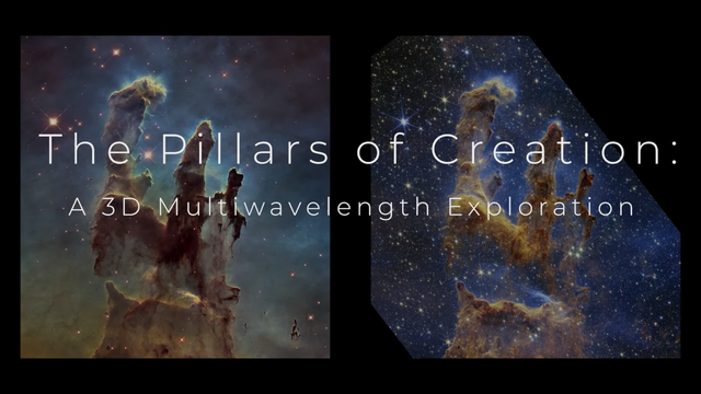
Using data from NASA's Hubble and Webb space telescopes, astronomers and artists modeled the iconic Pillars of Creation in the Eagle Nebula (Messier 16 or M16) in three dimensions, creating a movie that allows viewers to fly past and among the pillars.
The new visualization helps viewers experience how two of the world's most powerful space telescopes work together to provide a more complex and holistic portrait of the pillars. Hubble sees objects that glow in visible light, at thousands of degrees. Webb's infrared vision, which is sensitive to cooler objects with temperatures of just hundreds of degrees, pierces through obscuring dust to see stars embedded in the pillars.
A bonus product from this visualization is a new 3D printable model of the Pillars of Creation. The base model of the four pillars used in the visualization has been adapted to the STL file format, so that viewers can download the model file and print it out on 3D printers. Examining the structure of the pillars in this tactile and interactive way adds new perspectives and insights to the overall experience.
Printable 3D Model:
https://universe-of-learning.org/contents/products/pillars-of-creation-3d-model
Credit:
* Producers: Greg Bacon and Frank Summers (STScI), NASA's Universe of Learning;
* Visualization: Greg Bacon, Ralf Crawford, Joseph DePasquale, Leah Hustak, Danielle Kirshenblat, Christian Nieves, Joseph Olmsted, Alyssa Pagan, and Frank Summers (STScI), Robert L. Hurt (Caltech, IPAC); Science
* Advisor: Anna McLeod (Durham University);
* Music: Joseph DePasquale (STScI)
https://science.nasa.gov/missions/hubble/new-hubble-webb-pillars-of-creation-visualization/
#space #nebula #astrophotography #photography #science #astronomy #physics #nature #NASA #ESA #education
Alt...
Using data from NASA's Hubble and Webb space telescopes, astronomers and artists modeled the iconic Pillars of Creation in the Eagle Nebula (Messier 16 or M16) in three dimensions, creating a movie that allows viewers to fly past and among the pillars.
Credit:
* Producers: Greg Bacon and Frank Summers (STScI), NASA's Universe of Learning;
* Visualization: Greg Bacon, Ralf Crawford, Joseph DePasquale, Leah Hustak, Danielle Kirshenblat, Christian Nieves, Joseph Olmsted, Alyssa Pagan, and Frank Summers (STScI), Robert L. Hurt (Caltech, IPAC); Science
* Advisor: Anna McLeod (Durham University);
* Music: Joseph DePasquale (STScI)
2025 July 16
The Rosette Nebula from DECam
* Image Credit: CTIO, NOIRLab, DOE, NSF, AURA
https://noirlab.edu/public/programs/ctio/
https://noirlab.edu/
https://www.energy.gov/
https://www.nsf.gov/
https://www.aura-astronomy.org/
* Processing: T. A. Rector (U. Alaska Anchorage), D. de Martin (NSF’s NOIRLab) & M. Zamani
http://aftar.uaa.alaska.edu/
https://mahdizamani.com/about
https://www.uaa.alaska.edu/
https://www.nsf.gov/
https://noirlab.edu/public/
Explanation:
Would the Rosette Nebula by any other name look as sweet? The bland New General Catalog designation of NGC 2237 doesn't appear to diminish the appearance of this flowery emission nebula, as captured by the Dark Energy Camera (DECam) on the Blanco 4-meter telescope at the NSF's Cerro Tololo Inter-American Observatory in Chile. Inside the nebula lies an open cluster of bright young stars designated NGC 2244. These stars formed about four million years ago from the nebular material and their stellar winds are clearing a hole in the nebula's center, insulated by a layer of dust and hot gas. Ultraviolet light from the hot cluster stars causes the surrounding nebula to glow. The Rosette Nebula spans about 100 light-years across, lies about 5000 light-years away, and can be seen with a small telescope towards the constellation of the Unicorn (Monoceros).
https://en.wikipedia.org/wiki/Rosette_Nebula
https://noirlab.edu/public/images/noirlab2424a/
https://apod.nasa.gov/apod/ap000111.html
https://ui.adsabs.harvard.edu/abs/1993ApJ...414..664K/abstract
https://ui.adsabs.harvard.edu/abs/2000A%26A...358..553H/abstract
https://www.bartleby.com/lit-hub/familiar-quotations/1210-william-shakespeare-1564-1616-john-bartlett/
https://apod.nasa.gov/apod/ap030706.html
https://en.wikipedia.org/wiki/New_General_Catalogue
Location:
https://chandra.harvard.edu/photo/constellations/monoceros.html
https://noirlab.edu/public/programs/ctio/victor-blanco-4m-telescope/
https://noirlab.edu/public/programs/ctio/
https://noirlab.edu/public/programs/ctio/victor-blanco-4m-telescope/decam/
https://spaceplace.nasa.gov/constellations/en/
https://apod.nasa.gov/apod/ap250716.html
#space #nebula #astrophotography #photography #science #astronomy #physics #nature #NASA #education
, D. de Martin (NSF’s NOIRLab) & M. Zamani
Explanation:
Would the Rosette Nebula by any other name look as sweet? The bland New General Catalog designation of NGC 2237 doesn't appear to diminish the appearance of this flowery emission nebula, as captured by the Dark Energy Camera (DECam) on the Blanco 4-meter telescope at the NSF's Cerro Tololo Inter-American Observatory in Chile. Inside the nebula lies an open cluster of bright young stars designated NGC 2244. These stars formed about four million years ago from the nebular material and their stellar winds are clearing a hole in the nebula's center, insulated by a layer of dust and hot gas. Ultraviolet light from the hot cluster stars causes the surrounding nebula to glow. The Rosette Nebula spans about 100 light-years across, lies about 5000 light-years away, and can be seen with a small telescope towards the constellation of the Unicorn (Monoceros).
Authors & editors: Robert Nemiroff (MTU) & Jerry Bonnell (UMCP)
NASA Official: Amber Straughn Specific rights apply.")
Alt...
2025 July 16
A deep image of the Rosette Nebula is shown along with a field of stars. As many color filters were used, the flowery nebula takes on many colors with blue in the center, yellow and orange around the blue, and red around the outside.
The Rosette Nebula from DECam
* Image Credit: CTIO, NOIRLab, DOE, NSF, AURA
* Processing: T. A. Rector (U. Alaska Anchorage), D. de Martin (NSF’s NOIRLab) & M. Zamani
Explanation:
Would the Rosette Nebula by any other name look as sweet? The bland New General Catalog designation of NGC 2237 doesn't appear to diminish the appearance of this flowery emission nebula, as captured by the Dark Energy Camera (DECam) on the Blanco 4-meter telescope at the NSF's Cerro Tololo Inter-American Observatory in Chile. Inside the nebula lies an open cluster of bright young stars designated NGC 2244. These stars formed about four million years ago from the nebular material and their stellar winds are clearing a hole in the nebula's center, insulated by a layer of dust and hot gas. Ultraviolet light from the hot cluster stars causes the surrounding nebula to glow. The Rosette Nebula spans about 100 light-years across, lies about 5000 light-years away, and can be seen with a small telescope towards the constellation of the Unicorn (Monoceros).
Authors & editors: Robert Nemiroff (MTU) & Jerry Bonnell (UMCP)
NASA Official: Amber Straughn Specific rights apply.
2024 August 10
The Light, Dark, and Dusty Trifid
* Image Credit & Copyright: Robert Edelmaier and Gabriele Gegenbauer
https://www.astropicture.at/
Explanation:
Messier 20, popularly known as the Trifid Nebula, lies about 5,000 light-years away toward the nebula rich constellation Sagittarius. A star forming region in the plane of our galaxy, the Trifid does illustrate three different types of astronomical nebulae; red emission nebulae dominated by light from hydrogen atoms, blue reflection nebulae produced by dust reflecting starlight, and dark nebulae where dense dust clouds appear in silhouette. The reddish emission region, roughly separated into three parts by obscuring dust lanes, is what lends the Trifid its popular name. The cosmic cloud complex is over 40 light-years across and would cover the area of a full moon on planet Earth's sky. But the Trifid Nebula is too faint to be seen by the unaided eye. Over 75 hours of image data captured under dark night skies was used to create this stunning telescopic view.
https://apod.nasa.gov/apod/ap240810.html
#space #nebula #astrophotography #photography #science #astronomy #physics #nature #NASA #education
 & Jerry Bonnell (UMCP)
NASA Official: Amber Straughn Specific rights apply.
NASA Web Privacy, Accessibility Notices
A service of: ASD at NASA / GSFC,
NASA Science Activation
& Michigan Tech. U.")
Alt...
2024 August 10
The Light, Dark, and Dusty Trifid
* Image Credit & Copyright: Robert Edelmaier and Gabriele Gegenbauer
Explanation:
Messier 20, popularly known as the Trifid Nebula, lies about 5,000 light-years away toward the nebula rich constellation Sagittarius. A star forming region in the plane of our galaxy, the Trifid does illustrate three different types of astronomical nebulae; red emission nebulae dominated by light from hydrogen atoms, blue reflection nebulae produced by dust reflecting starlight, and dark nebulae where dense dust clouds appear in silhouette. The reddish emission region, roughly separated into three parts by obscuring dust lanes, is what lends the Trifid its popular name. The cosmic cloud complex is over 40 light-years across and would cover the area of a full moon on planet Earth's sky. But the Trifid Nebula is too faint to be seen by the unaided eye. Over 75 hours of image data captured under dark night skies was used to create this stunning telescopic view.
Authors & editors: Robert Nemiroff (MTU) & Jerry Bonnell (UMCP)
NASA Official: Amber Straughn Specific rights apply.
NASA Web Privacy, Accessibility Notices
A service of: ASD at NASA / GSFC,
NASA Science Activation
& Michigan Tech. U.
2025 July 21
Cat's Paw Nebula from Webb Space Telescope
* Image Credit: NASA, ESA, CSA, STScI
https://www.nasa.gov/
https://www.esa.int/
https://www.asc-csa.gc.ca/eng/
https://www.stsci.edu/
Explanation:
Nebulas are perhaps as famous for being identified with familiar shapes as perhaps cats are for getting into trouble. Still, no known cat could have created the vast Cat's Paw Nebula visible toward the constellation of the Scorpion (Scorpius). At 5,700 light years distant, Cat's Paw is an emission nebula within a larger molecular cloud. Alternatively known as the Bear Claw Nebula and cataloged as NGC 6334, stars nearly ten times the mass of our Sun have been born there in only the past few million years. Pictured here is a recently released image of the Cat's Paw taken in infrared light by the James Webb Space Telescope. This newly detailed view into the nebula helps provide insight for how turbulent molecular clouds turn gas into stars.
https://webbtelescope.org/contents/media/images/2025/129/01JY2AEHHAE4057AGG56YHW1CQ
https://en.wikipedia.org/wiki/NGC_6334
https://apod.nasa.gov/apod/ap250721.html
https://astronomy.swin.edu.au/cosmos/E/Emission+Nebula
https://www.giss.nasa.gov/research/briefs/archive/1998_canuto_01/
#space #nebula #astrophotography #photography #science #astronomy #physics #nature #NASA #education
. At 5,700 light years distant, Cat's Paw is an emission nebula within a larger molecular cloud. Alternatively known as the Bear Claw Nebula and cataloged as NGC 6334, stars nearly ten times the mass of our Sun have been born there in only the past few million years. Pictured here is a recently released image of the Cat's Paw taken in infrared light by the James Webb Space Telescope. This newly detailed view into the nebula helps provide insight for how turbulent molecular clouds turn gas into stars.
Authors & editors: Robert Nemiroff (MTU) & Jerry Bonnell (UMCP)
NASA Official: Amber Straughn Specific rights apply.
NASA Web Privacy, Accessibility, Notices;
A service of: ASD at NASA / GSFC,
NASA Science Activation
& Michigan Tech. U.")
Alt...
2025 July 21
In a starfield a nebula appears that has three main bright regions surrounding a dark central nebula.
Cat's Paw Nebula from Webb Space Telescope
* Image Credit: NASA, ESA, CSA, STScI
Explanation:
Nebulas are perhaps as famous for being identified with familiar shapes as perhaps cats are for getting into trouble. Still, no known cat could have created the vast Cat's Paw Nebula visible toward the constellation of the Scorpion (Scorpius). At 5,700 light years distant, Cat's Paw is an emission nebula within a larger molecular cloud. Alternatively known as the Bear Claw Nebula and cataloged as NGC 6334, stars nearly ten times the mass of our Sun have been born there in only the past few million years. Pictured here is a recently released image of the Cat's Paw taken in infrared light by the James Webb Space Telescope. This newly detailed view into the nebula helps provide insight for how turbulent molecular clouds turn gas into stars.
Authors & editors: Robert Nemiroff (MTU) & Jerry Bonnell (UMCP)
NASA Official: Amber Straughn Specific rights apply.
NASA Web Privacy, Accessibility, Notices;
A service of: ASD at NASA / GSFC,
NASA Science Activation
& Michigan Tech. U.
NASA’s Webb Scratches Beyond Surface of Cat’s Paw for 3rd Anniversary
NASA Webb Mission Team
It’s the cat’s meow! To celebrate its third year of revealing stunning scenes of the cosmos in infrared light, NASA’s James Webb Space Telescope has “clawed” back the thick, dusty layers of a section within the Cat’s Paw Nebula (NGC 6334). Focusing Webb’s NIRCam (Near-Infrared Camera) on a single “toe bean” within this active star-forming region revealed a subset of mini toe beans, which appear to contain young stars shaping the surrounding gas and dust.
Webb’s look at this particular area of the Cat’s Paw Nebula just scratches the surface of the telescope’s three years of groundbreaking science.
“Three years into its mission, Webb continues to deliver on its design – revealing previously hidden aspects of the universe, from the star formation process to some of the earliest galaxies,” said Shawn Domagal-Goldman, acting director of the Astrophysics Division at NASA Headquarters in Washington. “As it repeatedly breaks its own records, Webb is also uncovering unknowns for new generations of flagship missions to tackle. Whether it’s following up on the mysteries of dark matter with NASA’s nearly complete Nancy Grace Roman Space Telescope, or narrowing our search for life to Earth-like planets with the Habitable Worlds Observatory, the questions Webb has raised are just as exciting as the answers it’s giving us.”
[...]
The progression from a large molecular cloud to massive stars entails multiple steps, some of which are still not well understood by astronomers.
Video:
Zoom to the Cat's Paw Nebula
Credits:
* Video: Danielle Kirshenblat (STSCI)
* Narration: Danielle Kirshenblat (STSCI)
* Acknowledgement: Akira Fujii, VISTA and DSS
NASA, ESA, CSA, STSCI
#space #nebula #astrophotography #photography #science #astronomy #physics #nature #NASA #ESA #education
[...]
Located approximately 4,000 light-years away in the constellation Scorpius, the Cat’s Paw Nebula offers scientists the opportunity to study the turbulent cloud-to-star process in great detail. Webb’s observation of the nebula in near-infrared light builds upon previous studies by NASA’s Hubble and retired Spitzer Space Telescope in visible- and infrared-light, respectively.
With its sharp resolution, Webb shows never-before-seen structural details and features: Massive young stars are carving away at nearby gas and dust, while their bright starlight is producing a bright nebulous glow represented in blue. It’s a temporary scene where the disruptive young stars, with their relatively short lives and luminosity, have a brief but important role in the region’s larger story. As a consequence of these massive stars’ lively behavior, the local star formation process will eventually come to a stop.
Start with the toe bean at top center, which is nicknamed the “Opera House” for its circular, tiered-like structure. The primary drivers for the area’s cloudy blue glow are most likely toward its bottom: either the light from the bright yellowish stars or from a nearby source still hidden behind the dense, dark brown dust.
Just below the orange-brown tiers of dust is a bright yellow star with diffraction spikes. While this massive star has carved away at its immediate surroundings, it has been unable to push the gas and dust away to greater distances, creating a compact shell of surrounding material.
[...]
Credits:
* Producers: Greg Bacon (STScI), Frank Summers (STScI)
* Image Processing: Joe DePasquale (STScI)
* Music: Joe DePasquale (STScI)
* Designers: Ralf Crawford (STScI), Leah Hustak (STScI), Christian Nieves (STScI), Alyssa Pagan (STScI)
* Images: NASA, ESA, CSA, STScI; ESO/VISTA.
#space #nebula #astrophotography #photography #science #astronomy #physics #nature #NASA #education
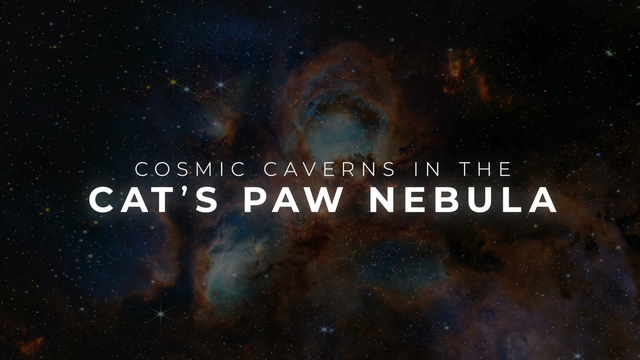
Alt...
This visualization explores a subset of toe bean-reminiscent structures within a section of the Cat’s Paw Nebula, a massive, local star-forming region located approximately 4,000 light-years away in the constellation Scorpius.
This image by NASA’s James Webb Space Telescope in near-infrared light was released in honor of the telescope’s third science operations anniversary. Since it began science operations in July 2022, Webb’s observations of our universe have wowed scientists and the public alike.
Glide into the lower left toe bean, moving past many small yellow stars along the way, where filaments of gas and dust frame the cavernous area. The region’s nebulous glow, represented in blue, is from the bright light of massive young stars.
Float toward the top toe bean, which is nicknamed the “Opera House” for its circular, tiered-like structure. As you move, you’ll pass plumes of orange-brown dust that vary in density and small, fiery red clumps where star formation is occurring, albeit in an obscured manner.
Credits:
* Producers: Greg Bacon (STScI), Frank Summers (STScI)
* Image Processing: Joe DePasquale (STScI)
* Music: Joe DePasquale (STScI)
* Designers: Ralf Crawford (STScI), Leah Hustak (STScI), Christian Nieves (STScI), Alyssa Pagan (STScI)
* Images: NASA, ESA, CSA, STScI; ESO/VISTA.
Hurricane Katrina: 20 Years Later
Twenty years ago, Hurricane Katrina devastated New Orleans and the Mississippi coast. It was one of the deadliest hurricanes on record and remains the costliest hurricane in U.S. history. The 2005 Atlantic hurricane season was record-breaking, with 27 named storms, 14 hurricanes, and three Category 5 storms. That record remained until 2020, when 30 named storms developed.
Learn how NOAA satellites tracked Katrina then, and how today’s advanced satellites provide even greeted insight into these powerful storms:
https://www.nesdis.noaa.gov/news/twen...
Credits:
NOAA
NASA
The Cooperative Institute for Research in the Atmosphere (CIRA)
Music:
“Formulas and Equations” by Richard Andrew Canavan [PRS]; Sound Pocket Music [PRS]; Universal Production Music
https://rammb.cira.colostate.edu/ramsdis/online/goes-west_goes-east.asp
#space #earth #astrophotography #photography #science #geology #nature #resources #climate #education
2017 May 15
Lightning Storm Moves Across the USA
* Image Credit: NOAA, NASA, Lockheed Martin, GOES-16, GLM
http://www.noaa.gov/
https://www.nasa.gov/
https://www.lockheedmartin.com/en-us/products/goes-r-series.html
https://www.nesdis.noaa.gov/our-satellites/currently-flying/geostationary-satellites
https://www.goes-r.gov/spacesegment/glm.html
Explanation:
Watch a huge lightning storm move across the eastern USA. The huge storm caused much damage and unfortunately some loss of life for people in its path. Seen from space, the lightning is seen as momentary flashes in the featured time-lapse video recorded last month by the Geostationary Lightning Mapper (GLM) aboard the GOES-16 satellite. The outline of North America is most evident during the day, while the bright lightning strikes are most evident at night. Inspection of the video shows that much of the lightning occurred at the leading edge of the huge tail of the swirling storm. Because lightning frequently precedes a storm's most violent impact, lightning data from GLM holds promise to help reduce the harm to humans from future storms.
https://www.nesdis.noaa.gov/news/first-of-its-kind-geostationary-lightning-mapper-glm-instrument-complete
https://www.goes-r.gov/
https://lightning.nsstc.nasa.gov/primer/
https://apod.nasa.gov/apod/ap170515.html
#space #earth #astrophotography #photography #science #geology #nature #resources #climate #education
2018 August 26
Fire on Earth
* Image Credit: John McColgan (AFS, BLM)
https://fire.ak.blm.gov/
https://www.blm.gov/
Explanation:
Sometimes, regions of planet Earth light up with fire. Since fire is the rapid acquisition of oxygen, and since oxygen is a key indicator of life, fire on any planet would be an indicator of life on that planet. Most of the Earth's land has been scorched by fire at some time in the past. Although causing many a tragedy, for many places on Earth fire is considered part of a natural ecosystem cycle. Large forest fires on Earth are usually caused either by humans or lightning and can be visible from orbit. Featured from the year 2000, stunned elk avoid a fire sweeping through Montana's Bitterroot Valley by standing in a river.
https://experience.arcgis.com/experience/92dfba48047d484b8868b35d0f708532/page/Page?views=Tab-Legend
https://firms.modaps.eosdis.nasa.gov/usfs/
https://en.wikipedia.org/wiki/Fire_ecology
https://science.nasa.gov/earth/
#space #earth #astrophotography #photography #science #geology #nature #resources #climate #education

Explanation:
Sometimes, regions of planet Earth light up with fire. Since fire is the rapid acquisition of oxygen, and since oxygen is a key indicator of life, fire on any planet would be an indicator of life on that planet. Most of the Earth's land has been scorched by fire at some time in the past. Although causing many a tragedy, for many places on Earth fire is considered part of a natural ecosystem cycle. Large forest fires on Earth are usually caused either by humans or lightning and can be visible from orbit. Featured from the year 2000, stunned elk avoid a fire sweeping through Montana's Bitterroot Valley by standing in a river.
Authors & editors: Robert Nemiroff (MTU) & Jerry Bonnell (UMCP)
NASA Official: Phillip Newman Specific rights apply.
NASA Web Privacy Policy and Important Notices
A service of: ASD at NASA / GSFC
& Michigan Tech. U.")
Alt...
2018 August 26
Fire on Earth
* Image Credit: John McColgan (AFS, BLM)
Explanation:
Sometimes, regions of planet Earth light up with fire. Since fire is the rapid acquisition of oxygen, and since oxygen is a key indicator of life, fire on any planet would be an indicator of life on that planet. Most of the Earth's land has been scorched by fire at some time in the past. Although causing many a tragedy, for many places on Earth fire is considered part of a natural ecosystem cycle. Large forest fires on Earth are usually caused either by humans or lightning and can be visible from orbit. Featured from the year 2000, stunned elk avoid a fire sweeping through Montana's Bitterroot Valley by standing in a river.
Authors & editors: Robert Nemiroff (MTU) & Jerry Bonnell (UMCP)
NASA Official: Phillip Newman Specific rights apply.
NASA Web Privacy Policy and Important Notices
A service of: ASD at NASA / GSFC
& Michigan Tech. U.
Published Sun, Jul 30 2017 on CNBC.com
Mysterious craters blowing out of Russia could mean trouble for the whole planet
by Stacey Yuen
In northern Siberia, rising temperatures are causing mysterious giant craters — and even more dire consequences could be in store, say climate scientists.
The Russian province’s long-frozen ground, called permafrost, is thawing, triggering massive changes to the region’s landscape and ecology. It could even threaten human lives.
“The last time we saw a permafrost melting was 130,000 years ago. It’s a natural phenomenon because of changes in the earth’s orbit,” said professor of earth sciences at the University of Oxford, Dr. Gideon Henderson.
“But what is definitely unprecedented is the rate of warming. The warming that happened 130,000 years ago happened over thousands of years … What we see happening now is warming over decades or a century.”
We are therefore seeing a much more rapid collapse of the permafrost, Henderson said.
Global warming — but faster
It’s clear that the thawing permafrost has an important effect on the climate, Henderson said.
Under normal conditions, permafrosts regulate the amount of carbon in the environment by taking up and storing significant portions of carbon that humans release from burning fossil fuel.
In the case of Siberia, this equation is being reversed.
“When [permafrosts] release carbon, it will accelerate the rate of warming in the future,” Henderson said. A self-reinforcing feedback loop is created whereby warming releases more carbon, which in turn produces greater warming.
Methane is 86 times worse than carbon dioxide
Since 2014, several massive sinkholes have been discovered in the region. The first one reportedly measured over 50 ft wide. [...]
#space #earth #astrophotography #photography #science #geology #nature #resources #climate #permafrost #education
Alt...
This video shows a crater on the Yamal Peninsula, northern Siberia, taken on August 25, 2014. Its formation is possibly linked to climate change.
CREDITS
Vasily Bogoyavlensky | AFP | Getty Images | CNBC
2018 December 18
Methane Bubbles Frozen in Lake Baikal
* Image Credit & Copyright: Kristina Makeeva
https://www.flickr.com/photos/23502952@N03/
Explanation:
What are these bubbles frozen into Lake Baikal? Methane. Lake Baikal, a UNESCO World Heritage Site in Russia, is the world's largest (by volume), oldest, and deepest lake, containing over 20% of the world's fresh water. The lake is also a vast storehouse of methane, a greenhouse gas that, if released, could potentially increase the amount of infrared light absorbed by Earth's atmosphere, and so increase the average temperature of the entire planet. Fortunately, the amount of methane currently bubbling out is not climatologically important. It is not clear what would happen, though, were temperatures to significantly increase in the region, or if the water level in Lake Baikal were to drop. Pictured, bubbles of rising methane froze during winter into the exceptionally clear ice covering the lake.
https://www.researchgate.net/publication/236143909_Sources_and_sinks_of_methane_in_Lake_Baikal_A_synthesis_of_measurements_and_modeling
https://science.nasa.gov/earth/climate-change/unexpected-future-boost-of-methane-possible-from-arctic-permafrost/
https://arctic-news.blogspot.com/2016/12/lake-baikal.html
https://www.cnbc.com/2017/07/30/siberian-craters-big-releases-of-methane-could-pose-broad-problems.html
https://en.wikipedia.org/wiki/Methane
https://en.wikipedia.org/wiki/Greenhouse_effect
https://apod.nasa.gov/apod/ap181218.html
#space #earth #astrophotography #photography #science #geology #nature #resources #climate #education
, oldest, and deepest lake, containing over 20% of the world's fresh water. The lake is also a vast storehouse of methane, a greenhouse gas that, if released, could potentially increase the amount of infrared light absorbed by Earth's atmosphere, and so increase the average temperature of the entire planet. Fortunately, the amount of methane currently bubbling out is not climatologically important. It is not clear what would happen, though, were temperatures to significantly increase in the region, or if the water level in Lake Baikal were to drop. Pictured, bubbles of rising methane froze during winter into the exceptionally clear ice covering the lake.
Authors & editors: Robert Nemiroff (MTU) & Jerry Bonnell (UMCP)
NASA Official: Phillip Newman Specific rights apply.
NASA Web Privacy Policy and Important Notices
A service of: ASD at NASA / GSFC
& Michigan Tech. U.")
Alt...
2018 December 18
Methane Bubbles Frozen in Lake Baikal
* Image Credit & Copyright: Kristina Makeeva
Explanation:
What are these bubbles frozen into Lake Baikal? Methane. Lake Baikal, a UNESCO World Heritage Site in Russia, is the world's largest (by volume), oldest, and deepest lake, containing over 20% of the world's fresh water. The lake is also a vast storehouse of methane, a greenhouse gas that, if released, could potentially increase the amount of infrared light absorbed by Earth's atmosphere, and so increase the average temperature of the entire planet. Fortunately, the amount of methane currently bubbling out is not climatologically important. It is not clear what would happen, though, were temperatures to significantly increase in the region, or if the water level in Lake Baikal were to drop. Pictured, bubbles of rising methane froze during winter into the exceptionally clear ice covering the lake.
Authors & editors: Robert Nemiroff (MTU) & Jerry Bonnell (UMCP)
NASA Official: Phillip Newman Specific rights apply.
NASA Web Privacy Policy and Important Notices
A service of: ASD at NASA / GSFC
& Michigan Tech. U.
2025 September 7
All the Water on Planet Earth
* Illustration Credit: Jack Cook, Adam Nieman, Woods Hole Oceanographic Institution
https://www.whoi.edu/
* Data source: Igor Shiklomanov
Explanation:
How much of planet Earth is made of water? Very little, actually. Although oceans of water cover about 70 percent of Earth's surface, these oceans are shallow compared to the Earth's radius. The featured illustration shows what would happen if all of the water on or near the surface of the Earth were bunched up into a ball. The radius of this ball would be only about 700 kilometers, less than half the radius of the Earth's Moon, but slightly larger than Saturn's moon Rhea which, like many moons in our outer Solar System, is mostly water ice. The next smallest ball depicts all of Earth's liquid fresh water, while the tiniest ball shows the volume of all of Earth's fresh-water lakes and rivers. How any of this water came to be on the Earth and whether any significant amount is trapped far beneath Earth's surface remain topics of research.
https://www.usgs.gov/media/images/all-earths-water-a-single-sphere
https://en.wikipedia.org/wiki/Origin_of_water_on_Earth
https://arxiv.org/abs/2503.17906
https://apod.nasa.gov/apod/ap250907.html
#space #earth #astrophotography #photography #science #geology #nature #resources #climate #education
 & Jerry Bonnell (UMCP)
NASA Official: Amber Straughn Specific rights apply.
NASA Web Privacy, Accessibility, Notices;
A service of: ASD at NASA / GSFC,
NASA Science Activation
& Michigan Tech. U.")
Alt...
2025 September 7
An illustration of planet Earth is shown where the Earth is tan and has no water shown on its surface. In the foreground are several small blue spheres showing how much water is known to reside on our planet.
All the Water on Planet Earth
* Illustration Credit: Jack Cook, Adam Nieman, Woods Hole Oceanographic Institution
* Data source: Igor Shiklomanov
Explanation:
How much of planet Earth is made of water? Very little, actually. Although oceans of water cover about 70 percent of Earth's surface, these oceans are shallow compared to the Earth's radius. The featured illustration shows what would happen if all of the water on or near the surface of the Earth were bunched up into a ball. The radius of this ball would be only about 700 kilometers, less than half the radius of the Earth's Moon, but slightly larger than Saturn's moon Rhea which, like many moons in our outer Solar System, is mostly water ice. The next smallest ball depicts all of Earth's liquid fresh water, while the tiniest ball shows the volume of all of Earth's fresh-water lakes and rivers. How any of this water came to be on the Earth and whether any significant amount is trapped far beneath Earth's surface remain topics of research.
Authors & editors: Robert Nemiroff (MTU) & Jerry Bonnell (UMCP)
NASA Official: Amber Straughn Specific rights apply.
NASA Web Privacy, Accessibility, Notices;
A service of: ASD at NASA / GSFC,
NASA Science Activation
& Michigan Tech. U.
TOPIC> Mother Earth
Our Great Mother Earth
It has produced all life and thus also us, who think we have to subdue it for supposedly religious reasons. Everyone at least pretends to love their mother, but do we really care about her?
The following video is already 14 years old, but how long has humanity been researching, discussing, debating and warning on the subject of environmental and climate protection?
I remember the first debates, demonstrations and information booths 45 years ago, but in reality this topic, which is often suppressed, has been in the consciousness of humanity for much longer and is fermenting there as a kind of guilty conscience.
And? Have we somehow changed our behavior, which has been trained by capitalist and industrial influences, for the better since then? Or have we become even more of the bestial, greedy predators that these influences would like us to be?
Is environmental awareness just an accessory, a label with which we adorn ourselves while we drive our car to the health food store to buy organic bread?
Do we manage to change or do we want to continue dancing on the edge of the abyss until it's finally over.. or is it already too late?
https://science.nasa.gov/climate-change/
Video Credit:
NASA's Global Climate Change website http://climate.nasa.gov/
#space #earth #astrophotography #photography #science #geology #nature #resources #climate #education #silentsunday

Alt...
The ocean is responsible for Earth's mild climate and makes life on Earth possible for all creatures. As global ocean temperatures increase, the ocean water expands causing sea level rise which can have disastrous impacts on low-lying coastal regions.
Produced by NASA's Global Climate Change website http://climate.nasa.gov/
Saturn's B Ring, for Harp and Drums (Excerpt)
SYSTEM Sounds converted the highest resolution color image of Saturn's rings into music. The brightness of each pixel is used to control the harp notes and drum sounds as well as their intensity. The notes correspond to the first 13 notes of the harmonic series. The image was taken on July 6, 2017 and shows a section within Saturn's dense B ring in natural color.
CREDIT:
SYSTEM Sounds
Full Video:
https://www.youtube.com/watch?v=VUZXl4tpabs
FYI:
https://youtu.be/DUdLRy8i9qI
#space #earth #tech #science #nature #education

Alt...
SYSTEM Sounds converted the highest resolution color image of Saturn's rings into music. The brightness of each pixel is used to control the harp notes and drum sounds as well as their intensity. The notes correspond to the first 13 notes of the harmonic series. The image was taken on July 6, 2017 and shows a section within Saturn's dense B ring in natural color.
The Earth Always Hums: Infragravity waves and current-generated noise and the microseisms (acceleration x6000)
Left: The spectrogram of the infragravity waves and current-generated noise (the time-variable broad bright spots on the left) and the ocean microseisms (the continuous band at higher frequencies, on the right of the spectrogram). The spectrogram shows the signal strength—or how loud it is—over time and at different frequencies. Labels and scales appear periodically. One of the horizontal scales at bottom left shows the original period of the signal in seconds. This signal is inaudible to the human ear. The recording has been accelerated by a factor of 6000, bringing all the signals into the audible range. The frequency scale (bottom left) marks the frequency (Hz) of the transformed signal that we hear. Right: the 3D visualization of the sound.
This stereo track is a rendering of the 3 components of the motion of the seafloor at a 3.9 km depth, southwest of Ireland. The seismograms were recorded on 1-19 April, 2020, by the ocean-bottom seismic station Brian of the SEA-SEIS network.
https://www.soundsoftheearth.ie/the-earth-always-hums-2/
https://www.youtube.com/channel/UC-50Ao7qpfTjFNb0oQFYyHQ
Credit for Video and Article
David Stalling
#earth #tech #science #nature #education
Alt...
The Earth Always Hums: Infragravity waves and current-generated noise and the microseisms (acceleration x6000)
Left: The spectrogram of the infragravity waves and current-generated noise (the time-variable broad bright spots on the left) and the ocean microseisms (the continuous band at higher frequencies, on the right of the spectrogram). The spectrogram shows the signal strength—or how loud it is—over time and at different frequencies. Labels and scales appear periodically. One of the horizontal scales at bottom left shows the original period of the signal in seconds. This signal is inaudible to the human ear. The recording has been accelerated by a factor of 6000, bringing all the signals into the audible range. The frequency scale (bottom left) marks the frequency (Hz) of the transformed signal that we hear. Right: the 3D visualization of the sound.
This stereo track is a rendering of the 3 components of the motion of the seafloor at a 3.9 km depth, southwest of Ireland. The seismograms were recorded on 1-19 April, 2020, by the ocean-bottom seismic station Brian of the SEA-SEIS network.
Credit for Video and Article
David Stalling
Video essay: What Lesia Kulchynska discusses about the gig economy in warfare and terrorism has an obvious positive correlation with commodity fetishism. She demonstrates public anger is not what brings revolutions anymore and that new strategies need to be considered.
https://www.tilley.blog/lesia-kulchynska-the-lure-of-war-video-essay/
70%
https://www.tilley.blog/category/70/
https://subspacewagon.systems/category/70/
#revolution #peacekeeping #community #communication #scicomm #academia #AcademicChatter #ConflictResolution #history #poetry #education #scifi #books